Description
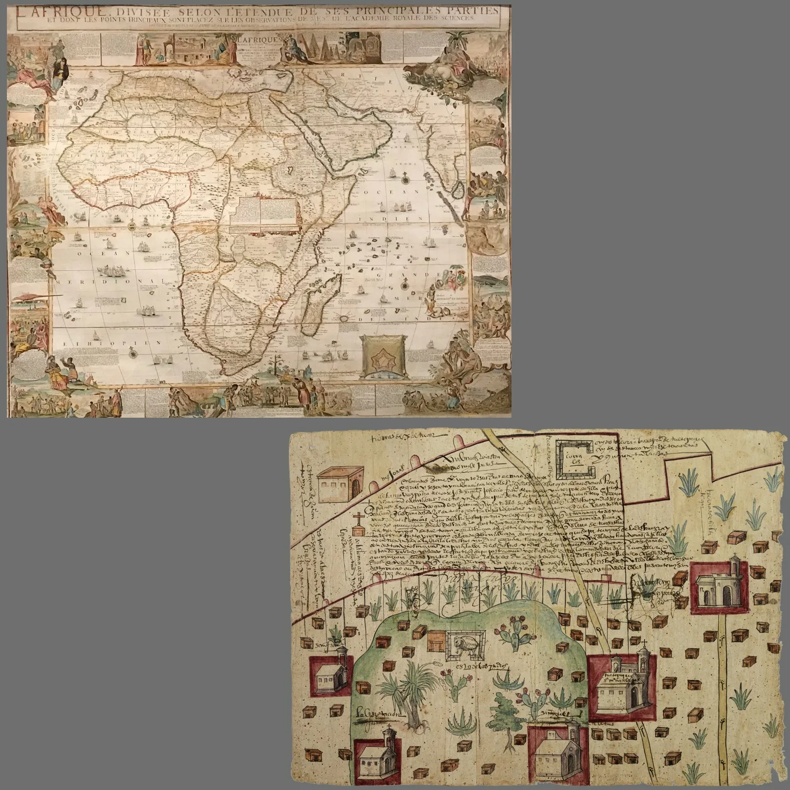
This program will explore the relationship between maps and race in two different cartographic projects from the early modern period: a set of richly-detailed world maps created by the French mapmaker Nicolas de Fer in the 1690s; and a map of a region around the town of Tultepec made by an anonymous Indigenous inhabitant of colonial Mexico to support a legal case against a Spanish rancher.
Ricardo Padrón will use the de Fer maps to explain how Western ideas about race developed in tandem with ideas about global geography, showing how the depiction of different peoples around the world laid the groundwork for theories of biological race in the eighteenth century. Risa Puleo then turns to the Indigenous map of Tultepec, showing how this map (and others like it) functioned as tools in the effort to resist racialized notions of property ownership that colonizers used to dispossess and displace Indigenous communities.
This program is co-organized with the Chicago Map Society, and is part of the Seeing Race Before Race exhibition project, now on view.
Speakers
Ricardo Padrón is a Professor of Spanish at the University of Virginia known for his research on the early modern cartographic imagination, tracing the relationship between mapping space, telling stories, and forging identities. He is the author of two books, The Spacious Word: Cartography, Literature, and Empire in Early Modern Spain (2004) and The Indies of the Setting Sun: How Early Modern Spain Mapped the Far East as the Transpacific West (2020). Both were published by the University of Chicago Press. His work has been supported by the American Council of Learned Societies and the National Endowment for the Humanities.
Risa Puleo is a doctoral candidate at Northwestern University in the Department of Art History. Her dissertation follows the Iberian Churra — the breed of Spanish sheep featured in the Tultepec map— and objects made from its wool into Central Mexico in the 16th, the American Southwest in the 19th, and into New York’s Museum of Modern Art in the early 20th century.
Registration Information
This hybrid program is free and open to all. No registration is required to attend in person. To join the program on Zoom, click on the registration link below.
